
Week 4 2023: Flooding rains possible for Louisiana. Snow forecast from Oklahoma to Michigan.
TLDR: The next system will bring flash flood potential to Louisiana on the warm side and heavy snow from Oklahoma to Michigan on the cold side.

Update:
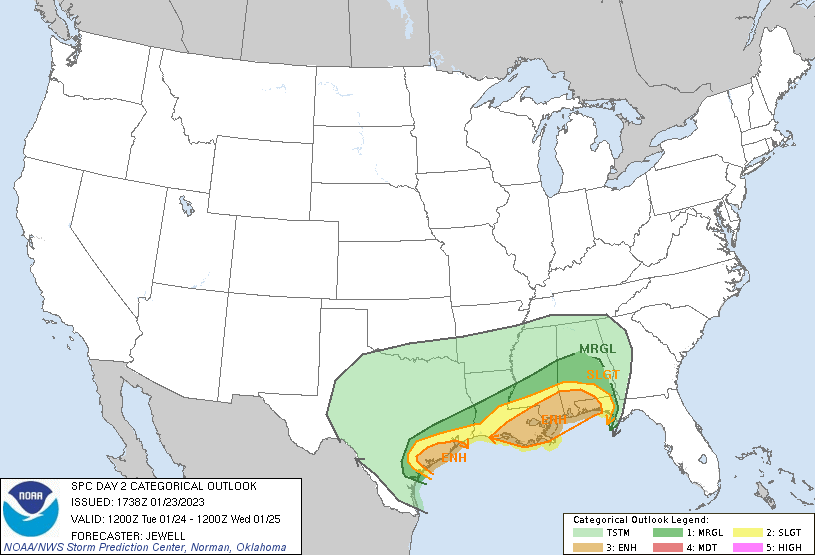
1/23/2023 3:00 PM: Contrary to my previous analysis, severe storms do look possible unfortunately for coastal portions of Texas and Louisiana. There the CAPE values are above 500 J/kg. When coupled with a >50kt 850mb low level jet this could lead to storms with damaging winds and possible tornadoes. SPC has an Enhanced risk of severe thunderstorms for the area tomorrow afternoon. Hopefully people have received the forecast and are ready for an active afternoon.
Main Story:
An impressive amount of rain is on the way for the Gulf Coast and Deep South with the formation of the next low pressure system on Tuesday. This area is no stranger to heavy rains, but with around 4" expected over the course of one evening there’s certainly a good chance for flooding. The Weather Prediction Center isn’t too impressed with the rainfall risk just yet with only a Slight Risk of Excessive Rainfall for parts of Texas, Louisiana, and Mississippi on Tuesday.
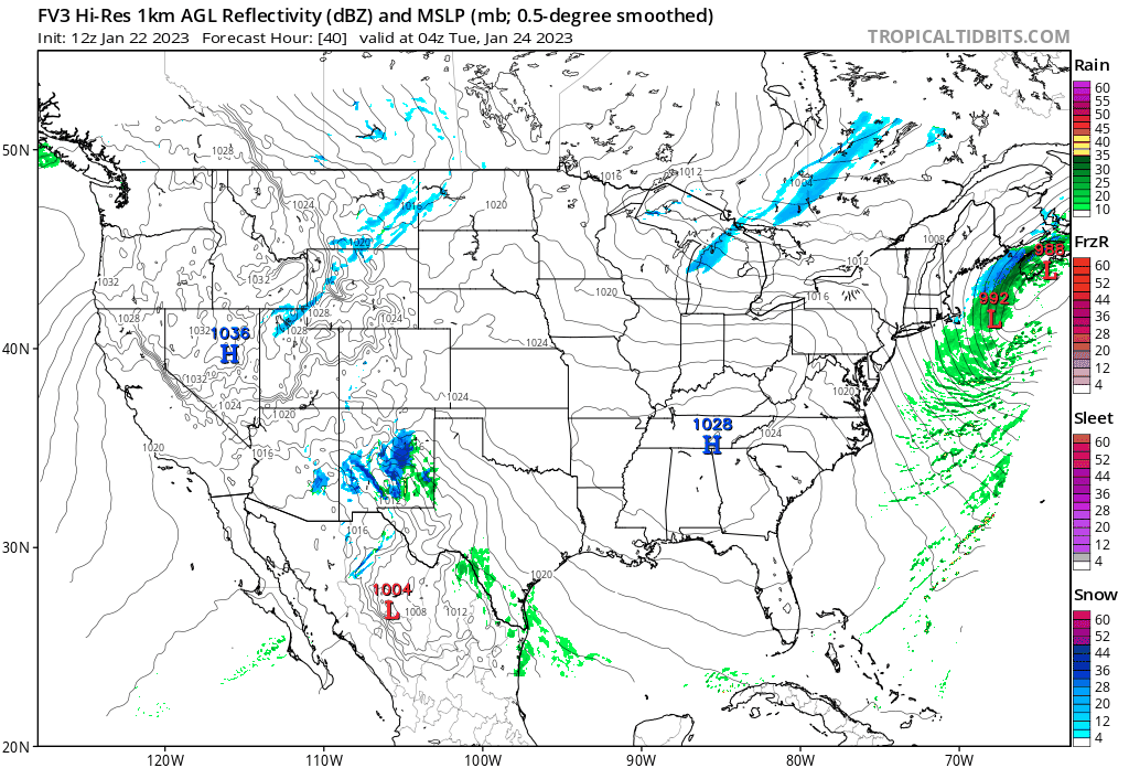
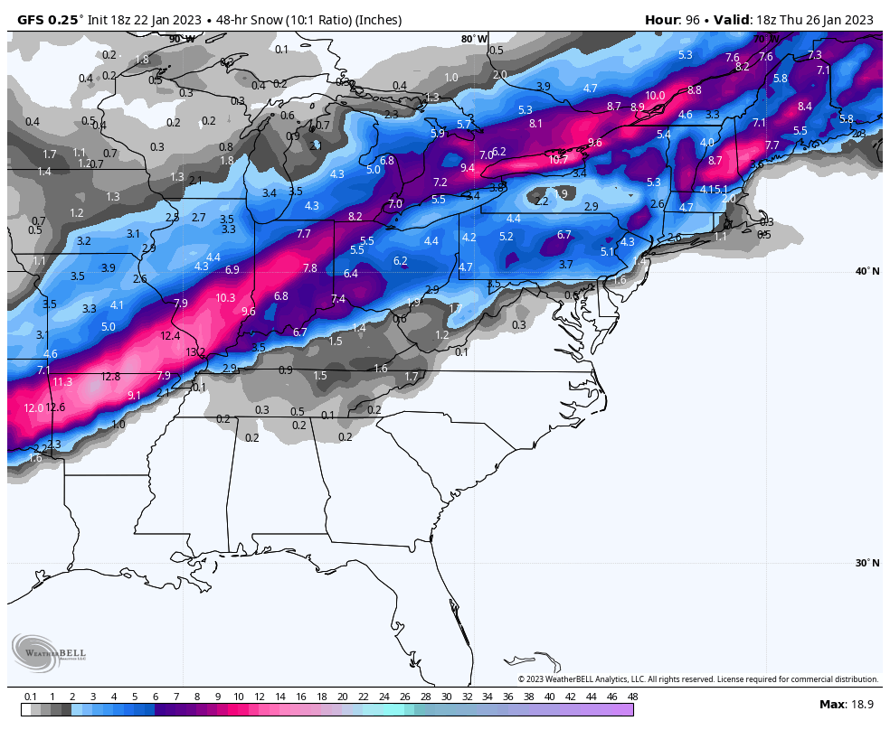
On the northern side of the system, we’ll also likely see heavy snow from Oklahoma all the way to Michigan through Wednesday as the system moves to the northeast. States like Arkansas and Oklahoma could see up to ten inches of snow which will certainly stop most movement and hopefully most traffic for the day Tuesday and through Wednesday evening.
Deeper Discussion:
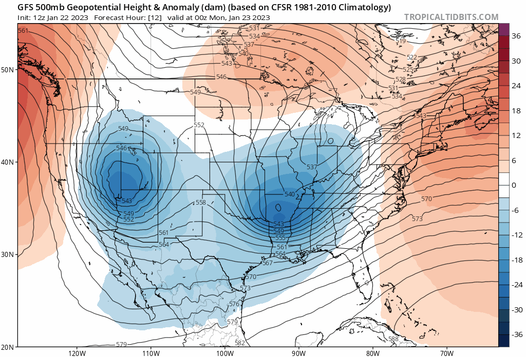
I’ll be following the movements of a digging trough that’s currently near Utah as it dives south into west Texas late in the day tomorrow. Then in the early morning Tuesday, deep Gulf moisture will be pulled up into central Texas where I’d expect to see line of thunderstorms form and move east during the evening hours on Tuesday.
A Little Jargon:
I’ve talked about my favorite moisture parameter precipitable water before in relations to flooding and this time is no different. The precipitable water values here will be around 1.4 to 1.6" which is well over the 90% moving average for this time of year. This hints heavily towards a flash flooding rain event. As for the strong to severe weather threat, the reason I’m not too worried is because instability values are almost non-existent when you look at model profiles.
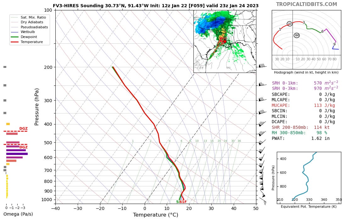
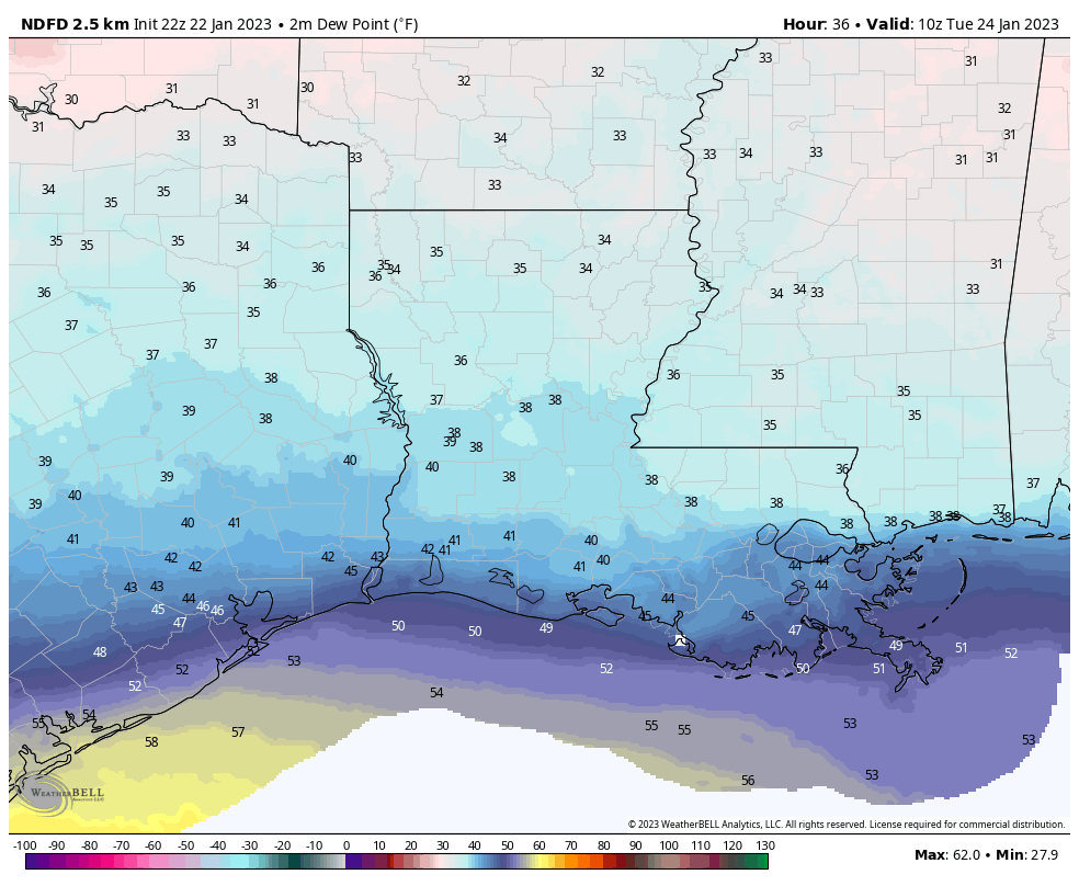
When it comes to heavy rain, I also like to look at the changes in dew point at the surface. Dew points will rise from the mid-30s into the 40s and 50s. While the system itself is pulling in moisture from a Gulf air mass with dew points in the upper-60s. All of this means there’s plenty of reason for the heavy rain with this system.
What Else I’m Watching:
After the rain on Tuesday, the focus will likely shift to the snow as it enters the Midwest and Great Lakes with some cities in the Northeast possibly seeing some snow late day Wednesday into Thursday. Following the cold front, you can bet by Friday everyone east of the Mississippi River will be feeling a renewed winter chill.
Final Thoughts:
Heavy rain happens, so that’s no surprise, but it’s my hope that the severe storms hold off. It’s fair to say that Louisiana, Mississippi, and Alabama have had enough of that this winter, so lets be grateful that the forecast is showing just rain.